Home
Welcome to SnowTinel! Sentinel-1 SAR assisted catchment hydrology: toward an improved snow-melt dynamics for Alpine regions. It is funded by the Swiss National Science Foundation under grant #205190.
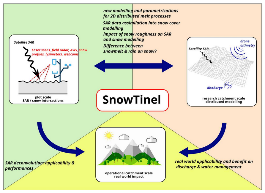
The project Snow-Tinel aims to understand better the capability of radar remote sensing to detect, monitor and predict snowmelt processes over mountainous regions. The project aims first at improving the understanding of the radar interactions with the wet snowpack evolution and then at evaluating the value of this information to enhance snowmelt modelling at the catchment scale. This is done considering three different scales:
- The remote sensing radar footprint scale at the Davos Laret site (~1 ha);
- The headwater catchment scale at the Dischma Valley close to Davos (~10 km2);
- The larger Venosta catchment in South Tyrol (~1000 km2).
The knowledge acquired at the small, remote sensing radar plot scale of Davos Laret will be compared to existing observations and integrated with existing distributed snow physical models and methods of different complexity in a very well-monitored small catchment (Dischma Valley, Davos). The best configurations will then be tested on the operational scenario of a large mountain catchment (Venosta Valley, South Tyrol) where accurate snowmelt estimation is needed since this area is already facing relevant water use conflicts as water is intensively used both by agriculture and hydropower production.